Find many different fishing hot spots with GPS coordinates.
The list below outlines the Lat/Lon location coordinates of many different reefs, wrecks, natural bottom structure and other places to fish in the waters off of Lee County, Florida. This area includes the waters off of Fort Myers, Cape Coral, Sanibel Island and Captiva Island.
Many different target fish species are abundant in the area, depending upon their particular season. Use the list of locations below to help you find great fishing and diving spots for this area. The coordinate numbers are in (DM) format.
Photo credit: Image from sxc.
Wrecks and Reefs of Lee County, Florida
| Name | Lat | Lon | Comments | Depth (ft) |
|---|---|---|---|---|
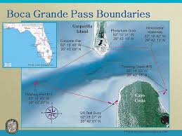
| Bay Ronto | 26 45.956N | 82 50.801W | wreck, 400' freighter approx 32 miles west of Boca Grande | 100 |
| Fantastico | 26 17.784N | 82 49.881W | wreck, 200' freighter | 105 |
| Fantastico | 26 17.776N | 82 50.081W | 105 | |
| Roatan Express | 26 20.358N | 83 22.027W | wreck, 180 ft. ship | 166 |
| Stoney Point | 26 10.287N | 82 54.520W | ship wreck | |
| Arc Barge | 26 24.905N | 82 24.691W | barge | 60 |
| Arc | 26 24.822N | 82 24.825W | culverts | 57 |
| Arc | 26 24.790N | 82 24.880W | culverts | 57 |
| Arc | 26 24.853N | 82 24.634W | concrete tetrahedrons | 58 |
| Arc - Reefballs | 26 24.894N | 82 24.622W | reef balls | 57 |
| Arc Seaguard | 26 24.963N | 82 24.719W | steel | 57 |
| ARCOA reef | 26 32.415N | 82 24.974W | concrete modules | 60 |
| ARCOA | 26 32.488N | 82 25.081W | concrete modules | 60 |
| ARCOA | 26 32.236N | 82 25.112W | concrete modules | 57 |
| Belton Johnson | 26 25.504N | 82 11.683W | culverts | 32 |
| Belton Johnson | 26 25.516N | 82 11.677W | culverts | 32 |
| Belton Johnson | 26 25.315N | 82 11.714W | pilings | 32 |
| Belton Johnson | 26 25.578N | 82 11.802W | concrete | 30 |
| Belton Johnson | 26 25.556N | 82 11.822W | concrete slabs | 32 |
| Belton Johnson | 26 25.453N | 82 12.094W | concrete slabs | 32 |
| Blanda's Reef | 26 25.364N | 82 18.941W | concrete reef balls | 38 |
| Blanda's | 26 25.314N | 82 19.086W | limestone boulders | 44 |
| Blanda's | 26 25.190N | 82 19.076W | bridge rubble | 44 |
| Blanda's | 26 25.266N | 82 19.039W | limestone rock | 43 |
| Blanda's | 26 25.186N | 82 19.102W | steel sailboat | 45 |
| Blind Pass | 26 29.250N | 82 12.449W | steel pipes | 20 |
| Blind Pass | 26 28.931N | 82 12.922W | 20 | |
| Bokeelia Reef | 26 43.036N | 82 09.640W | * inshore reef, culverts | 10 |
| Bokeelia Reef | 26 42.160N | 82 09.084W | * inshore reef, culverts, rubble | 10 |
| Boxcar | 26 42.029N | 82 35.972W | boxcars, hopper cars | 72 |
| Boxcar | 26 42.156N | 82 35.962W | boxcars, hopper cars | 72 |
| Boxcar | 26 41.882N | 82 35.941W | railroad hopper cars | 72 |
| Cape Haze | 26 45.763N | 82 09.491W | * inshore reef, culverts | 16 |
| Cape Haze | 26 45.724N | 82 09.462W | * inshore reef, culverts | 16 |
| Cape Haze | 26 45.752N | 82 09.402W | * inshore reef, concrete boxes | 16 |
| Cape Haze | 26 45.784N | 82 09.362W | * inshore reef | |
| Causeway Reef | 26 22.941N | 82 01.152W | 27 | |
| Causeway Reef | 26 22.841N | 82 01.246W | 27 | |
| Causeway Reef | 26 22.855N | 82 01.149W | 27 | |
| Causeway Reef | 26 22.898N | 82 01.118W | 27 | |
| Causeway Reef | 26 23.031N | 82 01.182W | 27 | |
| Charlie's | 26 33.382N | 82 43.370W | railroad cars | 89 |
| Charlie's | 26 29.981N | 82 43.462W | barges | 89 |
| Charlotte's | 26 45.768N | 82 27.539W | concrete | 50 |
| Charlotte's | 26 45.842N | 82 27.429W | limestone rock | 50 |
| Danger Reef | 26 45.551N | 82 11.179W | 12 | |
| Dean Hicks | 26 22.179N | 82 17.302W | limestone rock | 45 |
| Dean Hicks | 26 22.201N | 82 17.278W | limestone rock | 45 |
| Doc Kline | 26 19.711N | 82 05.539W | concrete boxes | 30 |
| Doc Kline | 26 20.275N | 82 05.118W | 30 | |
| Edison | 26 18.498N | 82 13.142W | 42 | |
| Edison | 26 18.572N | 82 13.269W | 42 | |
| G-H | 26 20.881N | 81 57.172W | 28 | |
| G-H | 26 20.856N | 81 57.129W | 28 | |
| G-H | 26 20.738N | 81 57.188W | 28 | |
| G-H | 26 20.902N | 81 57.448W | 28 | |
| Helen's | 26 37.928N | 82 17.158W | barges | 30 |
| Helen's | 26 38.029N | 82 17.432W | barge | 30 |
| Helen's | 26 38.223N | 82 17.094W | 30 | |
| Jaycees Reef | 26 20.150N | 82 05.554W | culverts | 30 |
| Jaycees | 26 20.149N | 82 05.35W | culverts | 30 |
| Jaycees | 26 20.08N | 82 05.35W | culverts | 30 |
| Marys | 26 46.268N | 82 18.472W | 31 | |
| Marys | 26 46.211N | 82 18.404W | 31 | |
| May | 26 22.701N | 81 55.091W | 20 | |
| May | 26 22.336N | 81 55.029W | 20 | |
| Pace's Place | 26 31.173N | 82 16.970W | 36 | |
| Pace's Place | 26 31.172N | 82 17.045W | 50' Wildman's Reef | 36 |
| Pace's Place | 26 31.252N | 82 16.936W | 36 | |
| Pace's Place | 26 31.209N | 82 16.979W | ||
| Pace's Place | 26 31.099N | 82 16.908W | ||
| Pegasus Tugboat | 26 33.13N | 82 43.41W | 85 | |
| Power Pole | 26 40.954N | 82 22.318W | 42 | |
| Power Pole | 26 40.826N | 82 22.349W | 42 | |
| Power Pole | 26 40.96N | 82 22.469W | 42 | |
| Redfish Barge | 26 33.479N | 82 14.599W | steel barge | 24 |
| Redfish Barge | 26 33.554N | 82 14.185W | steel barge | 24 |
| Sanibel Reef | 26 24.946N | 82 03.16W | 20 | |
| Sanibel | 26 24.285N | 82 03.120W | ||
| School Bus | 26 35.968N | 82 28.364W | 64 | |
| School Bus | 26 36.046N | 82 28.362W | 64 | |
| School Bus | 26 36.369N | 82 27.219W | 64 | |
| Sherman's | 26 32.49N | 82 25.08W | blocks | 58 |
| Sherman's | 26 32.466N | 82 25.029W | concrete slabs | 58 |
| Sherman's | 26 33.084N | 82 24.83W | culverts | 58 |
| Shirley D Boat | 26 32.922N | 82 24.816W | 58 | |
| Vixen Wreck | 26 32.851N | 82 24.78W | 58 | |
Discover and Explore this vibrant marine ecosystem.


